Hiking Cutler Coast Public Reserved Land
Challenging Hike in Maine
I’ve said it so many times, and I’ll keep on saying it— Maine is home to some of the most scenic hikes you will ever experience! Whether mountains are your flavor, or the more rugged coastline gets your fanny packing, you’re going to find something just right for you here in Cutler Coast Public Reserved Land.

Now if you’re the really adventurous and experienced type, boy do I have a hike for you! This one has your true Downeast coast with soaring ledges, steep elevation changes to scramble and climb, forested boardwalks, and boggy bridges (we’ll talk about these and how they went oh-so-wrong for us, soon enough!). The views on this trail rival anything found in Acadia National Park.
It sounds like the perfect trail, right? Well, check your ability-level and your ego at the trail head. This trail will humble you really fast. Trust me.
Fairy Head Loop Trail
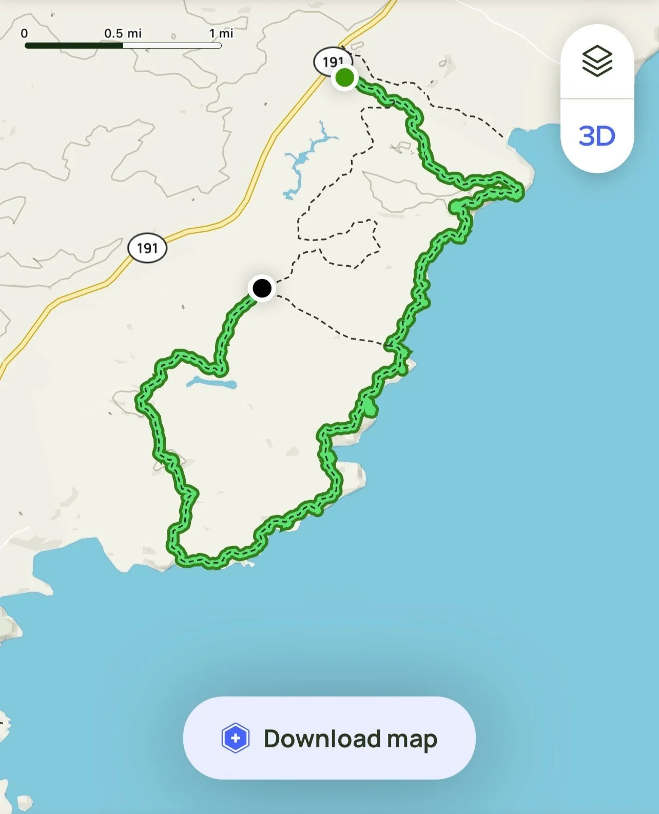
Fairy Head Loop Trail is part of the Cutler Coast Public Reserved Land in Cutler, Maine. It is an ambitious and challenging 10.4 mile loop trail situated along the dramatic coastline of Downeast Maine. It has an overall elevation gain of 1,076 feet, and features rock and ledge scrambling, forested trails, boardwalks, stepping stones, and a climbing rope for accessing the trail at the top of a steep banking. Multiple campsites can be found along the trail and feature stunning views of Grand Manan Channel.

Shaun with The Bearded Mainer Photography along the coast on Fairy Head Loop Trail. Photo Credit: Whimsy and Wilderness Photography
It was the end of March when that spring itch to hit the trails set in. After being cooped up all Winter, I couldn’t wait any longer to get out to some of my favorite Downeast spots. But I was also feeling kinda lonesome with the thought of going alone.
It just so happened my friend and fellow adventure photographer, Stephanie from Whimsy and Wilderness Photography was feeling the exact same way (it’s almost like the fates wanted us to endure this together!). We had not seen each other since we photographed a beautiful Bar Harbor Wedding together over the past Summer, so we knew it would be great to reconnect with a day long hike without the kids.
After debating whether we should hike Western Head Preserve Trail, or Fairy Head Loop Trail, we decided that Fairy Head looked like the PERFECT way to break out of our seasonal hibernation, and get a good warm up in before our busy photography season arrived.

My trail buddy Stephanie from Whimsy and Wilderness Photography.
Stephanie had some experience with our selection, having already photographed an elopement on the Coastal Trail (GOALS!), but she admitted she had not completed the entire trail. Personally I had not visited the trail prior to this hike, but it had been living on my All Trails wishlist for a LONG TIME.
With our decision made I packed everything into my Gitzo Camera Back Pack. My camera and favorite lenses, plenty of water and food, dry clothes, extra warm layers, and my most comfy LL Bean sweater. Stephanie even brought a blanket and a head lamp; everything we thought we’d need.
Doing Your Trail Research
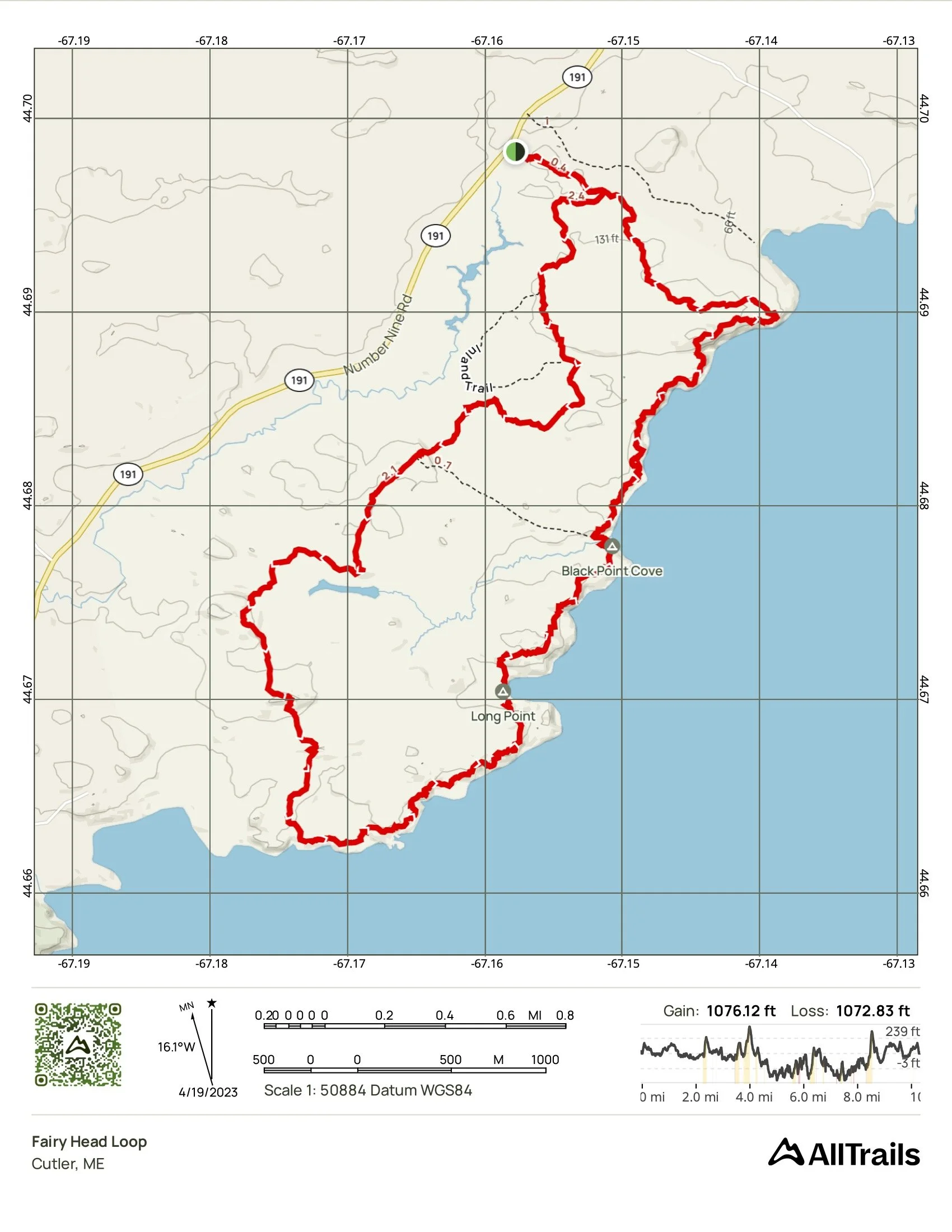
Fairy Head Loop Trail map
Map Credit: All Trails
When you think of finding a hiking trail, you probably have a go-to app or website you like to reference. For me, it’s All Trails. I love my All Trails+ membership, and I use it a whole lot during the warmer hiking seasons. Even my client session Location Guides have All Trails page links built in. But there is some wisdom all experienced hikers know to heed before heading out on a new trail; never trust just All Trails. It is always good to double check your trail info, especially with harder rated hikes such as Fairy Head Loop. You can do this by visiting sites such as mainetrailfinder.com or asking in the Maine Hiking Facebook Group. I cannot stress enough how important it is to be aware of your own ability level, and knowing the trail conditions before you go.
Had we followed the advice above that we give all of our clients before an adventure session, we would have approached this trail differently and avoided all of the toil and trouble we got ourselves into. Instead, our ambition and excitement for this trail outweighed our measured preparation.
This story begins where all good hiking stories do; at the Trail Head.
Trail Conditions on Fairy Head Loop.
The Trail Head for Fairy Head Loop is located on Route 191 in Cutler. The parking lot has multiple spots, and an outhouse. Online I read that there is a log book to sign at the Trail Head, though I did not see one present when we visited.
Stephanie and I knew going into this hike that we would be encountering multiple trees that had been blown down. The comments on All Trails had already warned us of that. Both of us have experienced blow downs in the past, so we thought nothing of the comments we read and figured it would be easy enough to hop over or around them.

A small blow down across the Coastal Trail
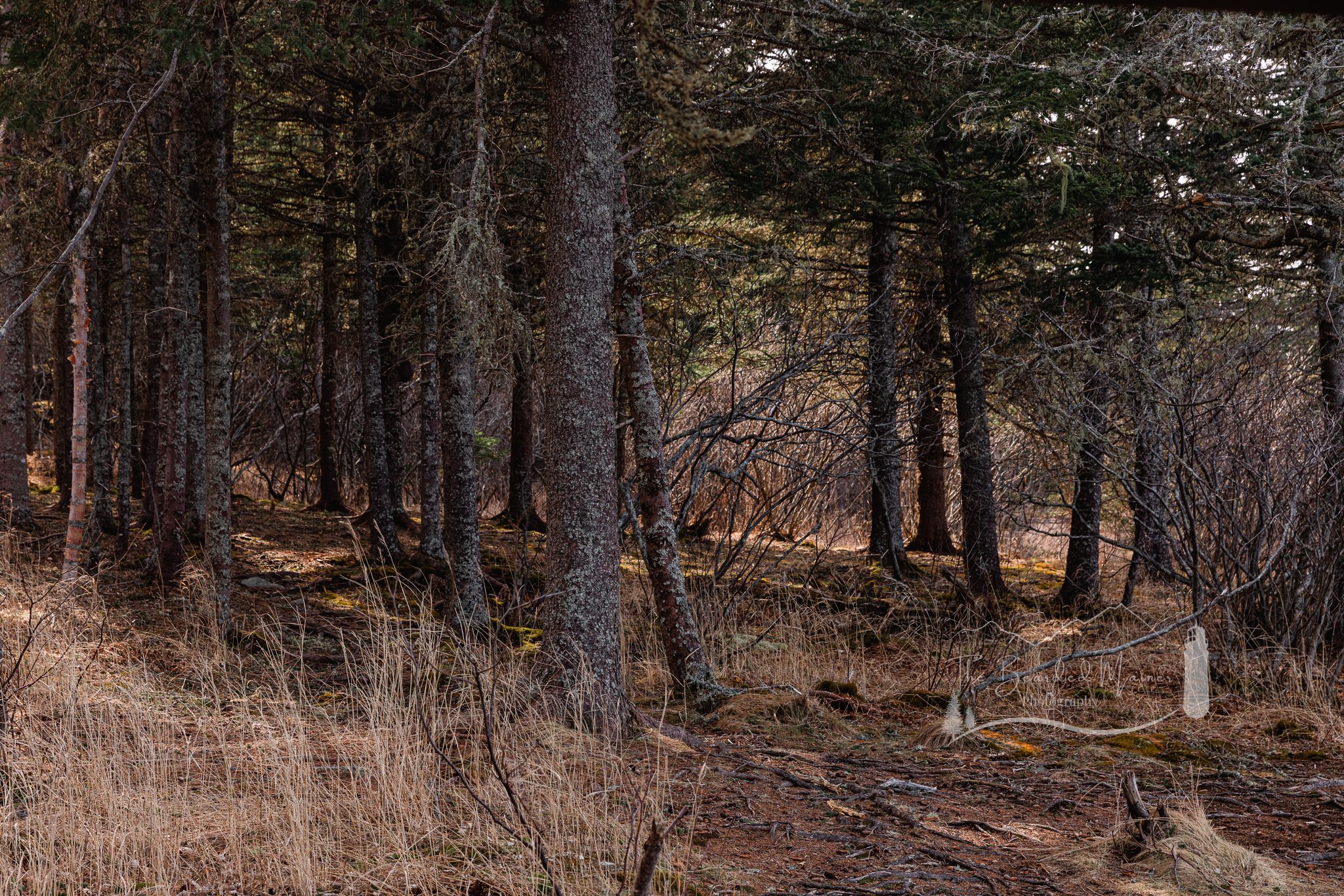
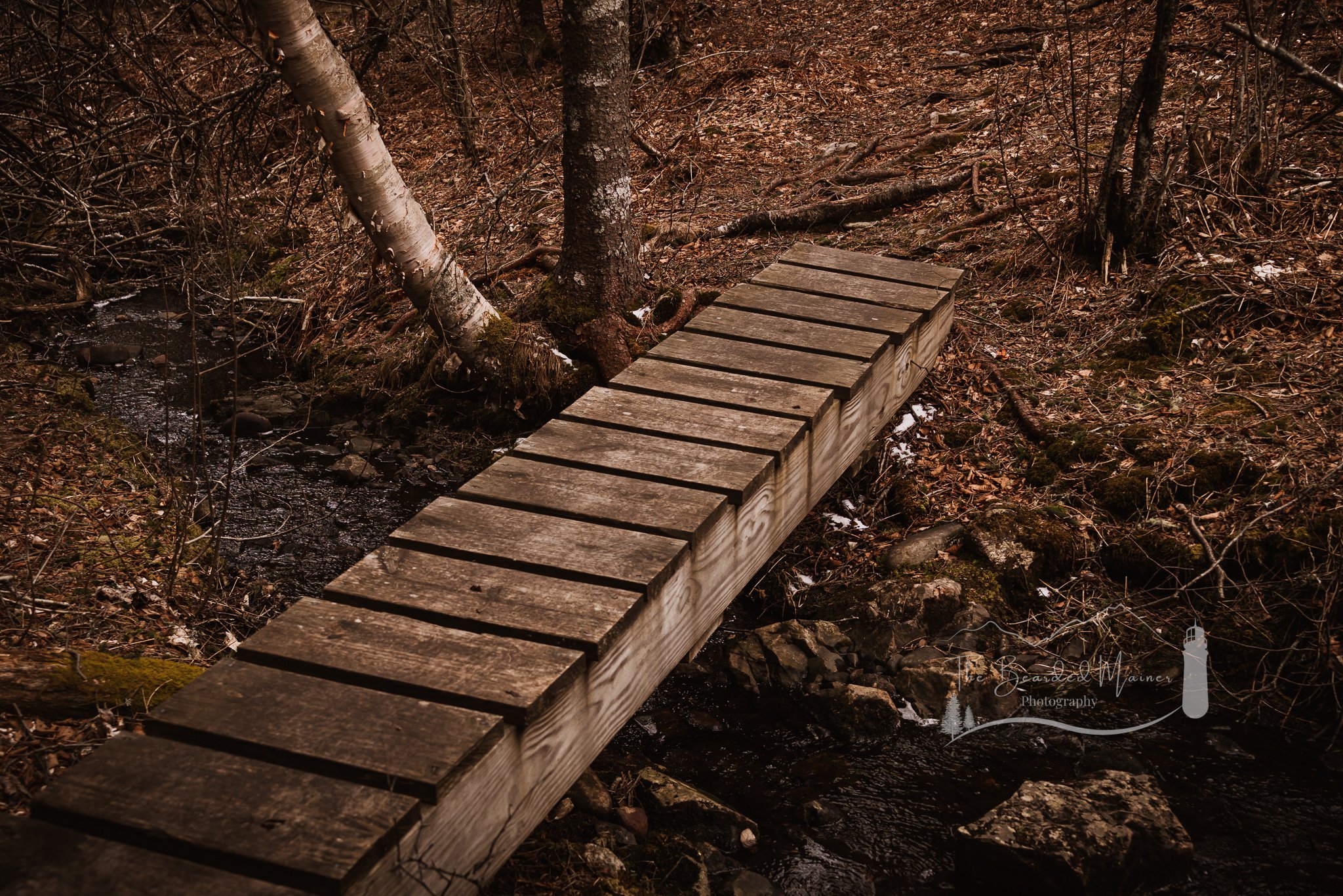
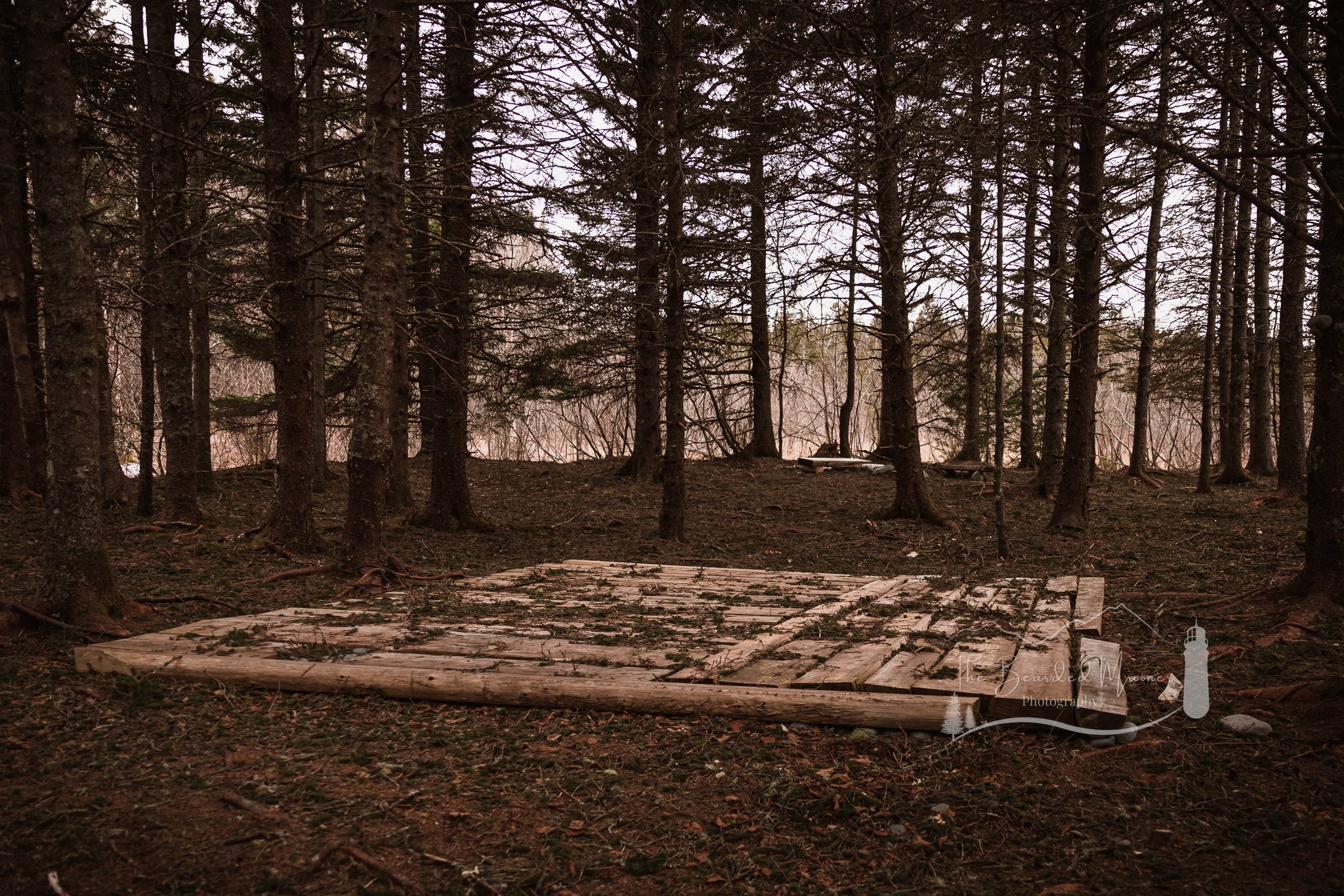
The trees we encountered were HUGE. If they weren’t huge, there were multiple smaller trees felled in a pile on the trail instead. Clearly Mother Nature had a statement to make out here. We started off slow and methodical with our passing over or around these trees. But as time went on our surprise at the quantity of fallen trees kept growing, and our patience with them thinning. Once we got out of the blow downs we trekked along some deteriorated boardwalks and made our away across a series of stepping stones on our way to the coast.
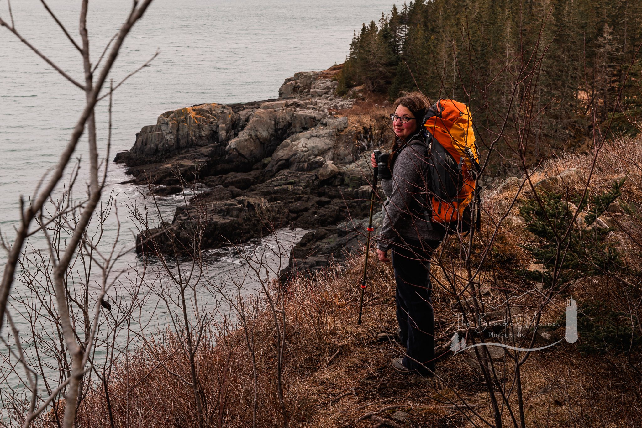
We chose to face this hike by traveling the Coastal Trail out to the head, and return back to the Trail Head via the Inland Trail. A sensible choice since we knew we would take more time observing and enjoying the coastal scenery.
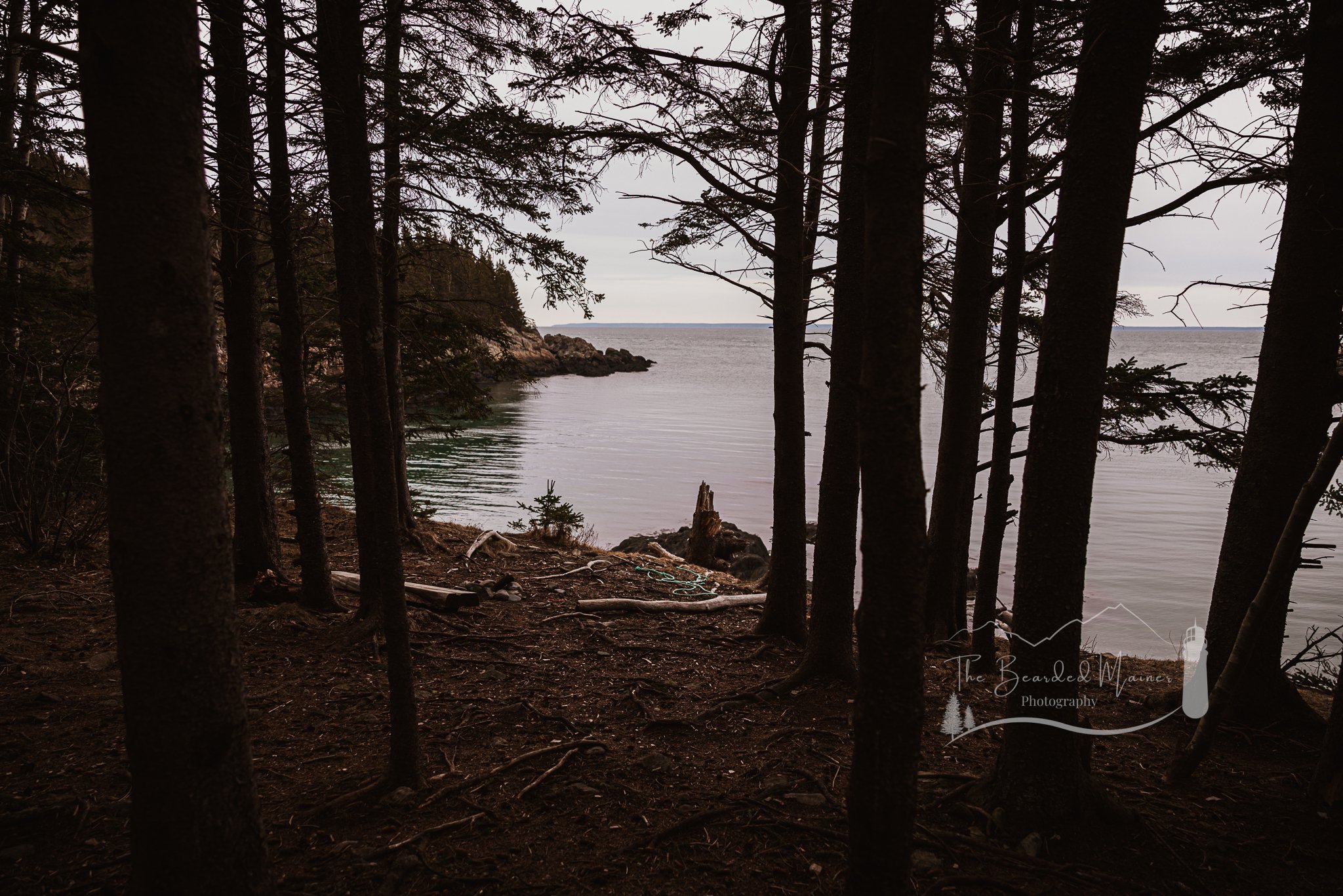
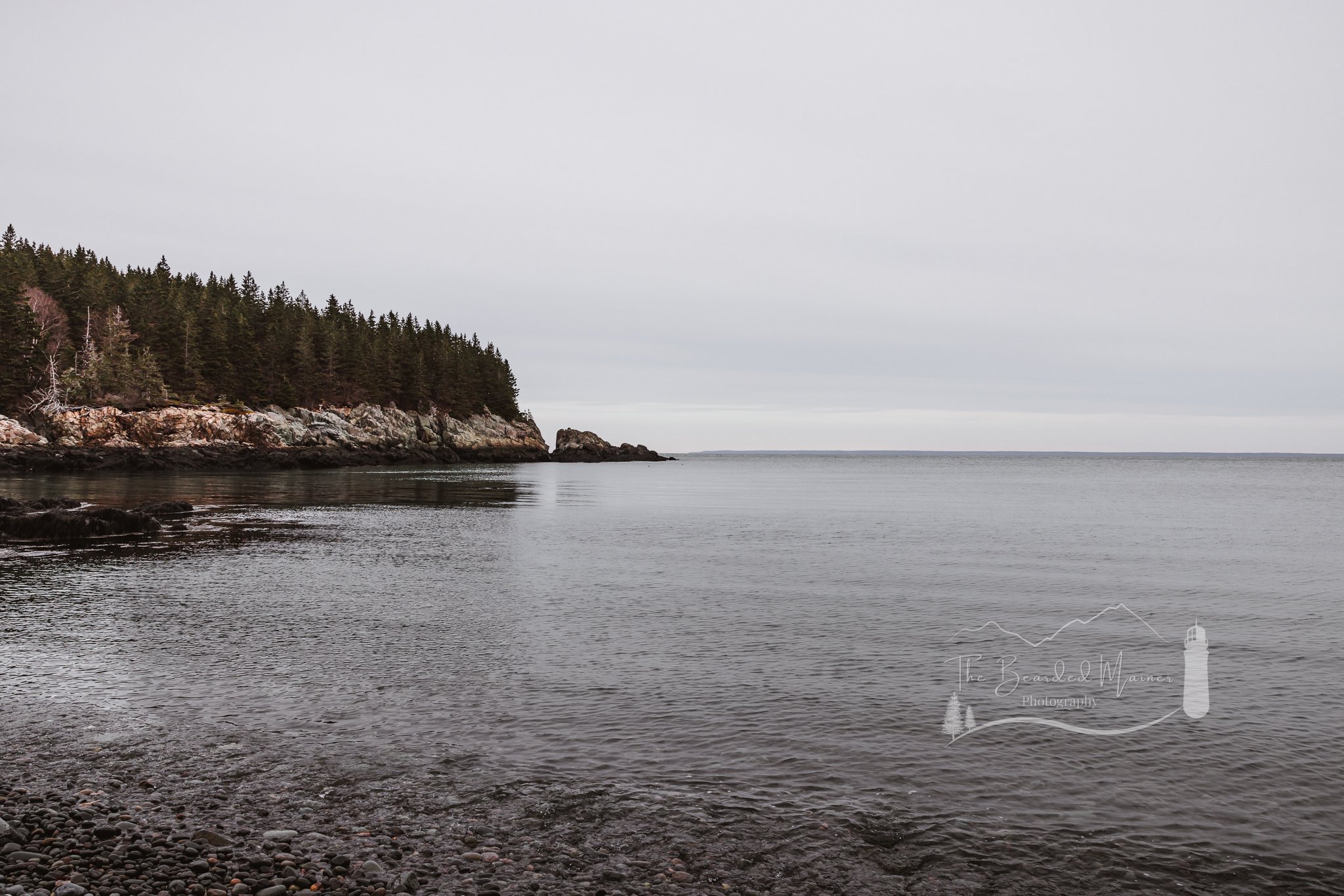
The Coastal Trail

Scenic Overlook on The Coastal Trail - Cutler Coast Public Reserved Land - March 2023
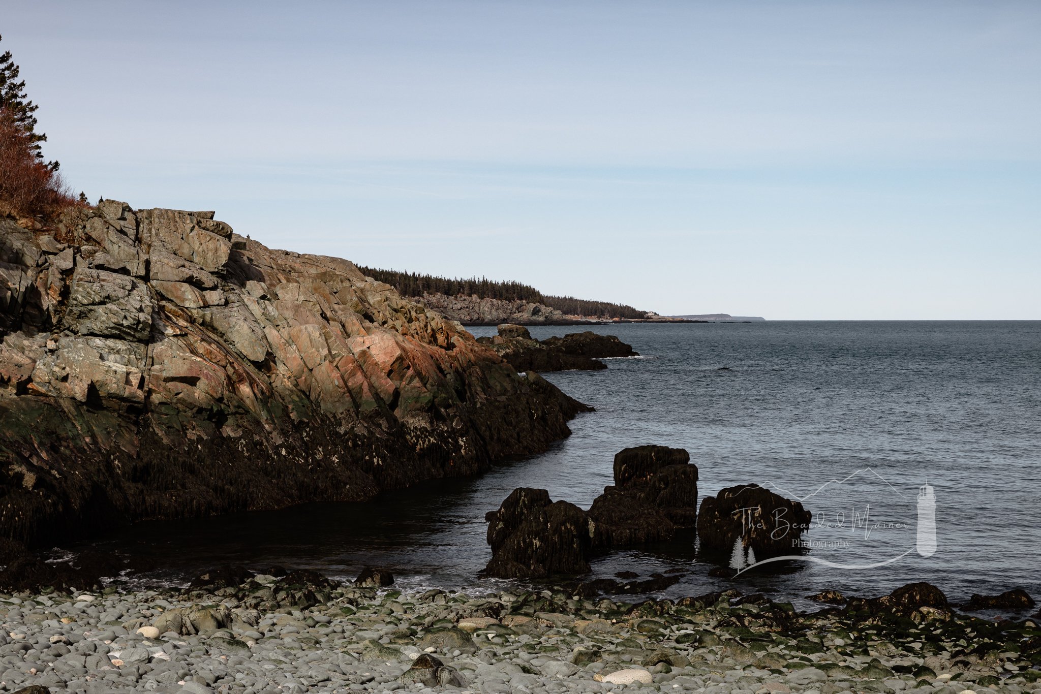
Traveling the coastal trail was fun, but strenuous at times as you climb up and down with every valley and cove along the shoreline. In the areas where the trail swept inland, we found that it was very easy to get off trail if you were not paying close enough attention. The markings out here are far and few between. My guess would be this is due to the number of trees that have fallen, taking any blazes, and sign of the trail, with them.

Inclines like these are common along the Coastal Trail as you wind along the jagged Cutler coastline.
The brush and grass has grown over the trail in areas too, making it hard to determine if you are even on the trail at all. Add in the heavily trafficked deer trails that look as clear as the hiking trail itself, and you’re in for some trouble navigating. Multiple times we found ourselves off trail, as we followed an animal crossing, instead of turning with the trail. We can confirm on one occasion it was due to no markings directing the trail around a turn, and a deer path continuing straight along the same course we had been walking. Though the views from this spot were great, we felt pretty embarrassed to have gone so far off trail without even noticing it. I can’t imagine how hard this trail must be to navigate once foliage and grass has grown in for the season.
Admittedly, we made too many stops along the way, got too far off trail and had to retrace steps, and took too long documenting our time out there. It wasn’t until we reached the campsites that we realized we needed to pick up our pace, or we were going to end up out there after dark.
Hidden Gem in Maine
How could we not help stopping so much though? Parts of this trail truly look surreal; we even joked it looked like a whole different planet! We HAD to stop and take it all in. Mind you, it’s easy to get lost in the landscape views and forget about the smaller details that are just below your feet.

Stephanie photographing the coastline of Fairy Head Loop Trail
The rock formations along this coastline are fascinating! With sheer ledges, jagged edges, crazy rock layers, glacial erratics, and seemingly endless colors. The smaller stones along the shore have been polished smooth from millennia of crashing waves. It is simply mind blowing to experience this raw slice of Earth. Do I have any Geologist friends who want to go for a hike with me? *wink wink


Meanwhile, the plant life is beautiful and ready for Spring’s sunny days. I absolutely love observing how the plants and trees vary in Maine depending on what part of the state you are in. Here on the coast, plant life is built tough. It looks as rugged and worn as an old salty sailor (fitting). For years they have withstood the harassing winds and salty spray that comes off the unforgiving coastline, and they’ll keep doing it long past our time here; a true testament to their nature. But through the scars of storms-gone-by, there is still a beauty about these plants and trees, and how they have adapted to their environment. The biggest life lesson they remind me of? If something gets in your way, GROW AROUND IT.
Because of the season, there is little foliage, so the reds, yellows, and oranges of the coast take the spotlight. Personally I love the colors this time of year, but I’d be intrigued to see this coastline once the summer days are upon us, though portions of the trail may legitimately be too overgrown to easily follow by then; particularly on the Inland Trail.
Camping in Cutler Coast Public Reserved Land
Traveling onward, we made it to the first campsite along our way; Black Point Cove.
Wow. Just wow.
Personally, I’m not much of a deep woods camper. It’s just never been my jam, but I’d give one of the campsites out here a try. I have learned to love a lot of new things in my 30’s that my 20’s would never have considered! For this trip though, we were just passing through.
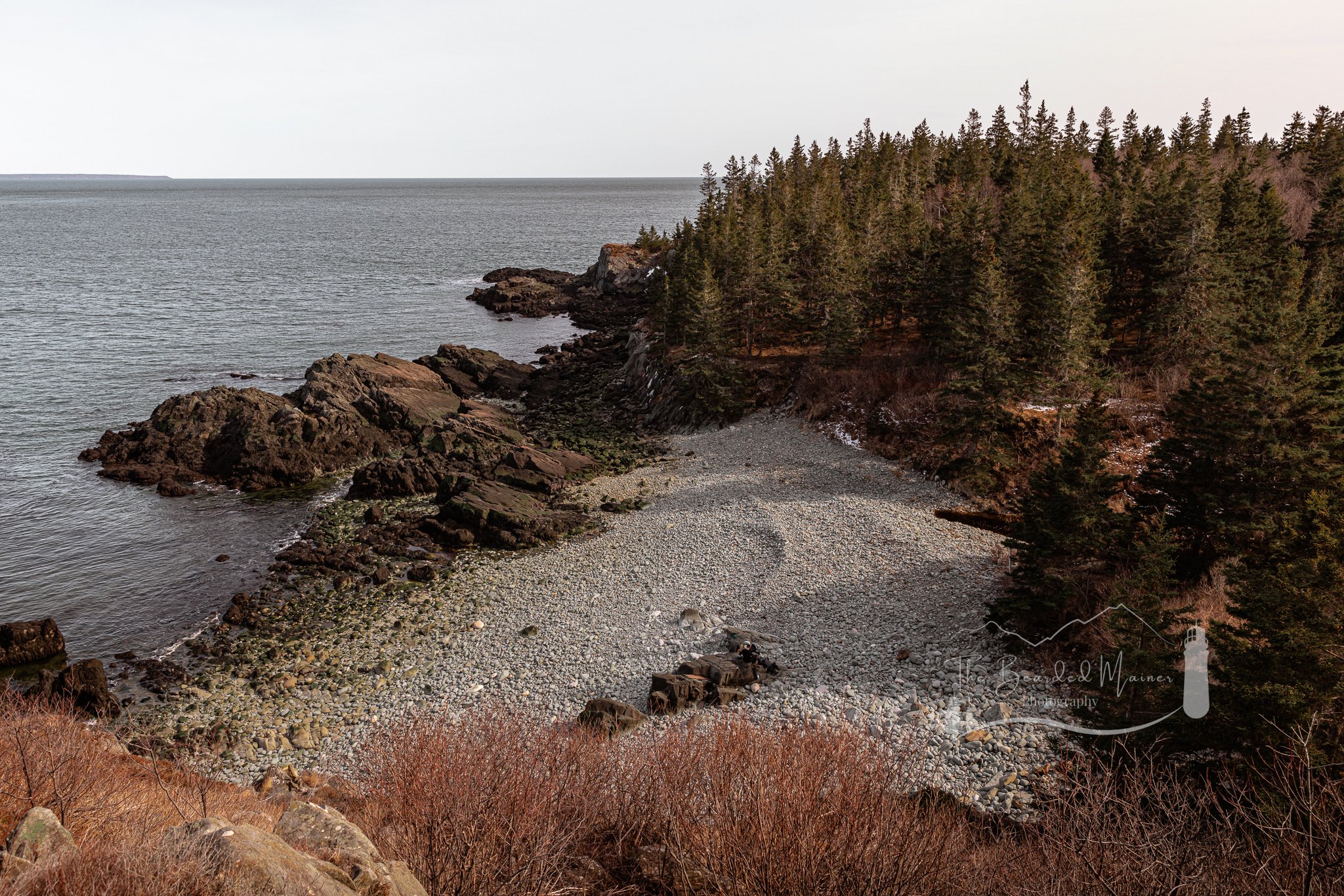
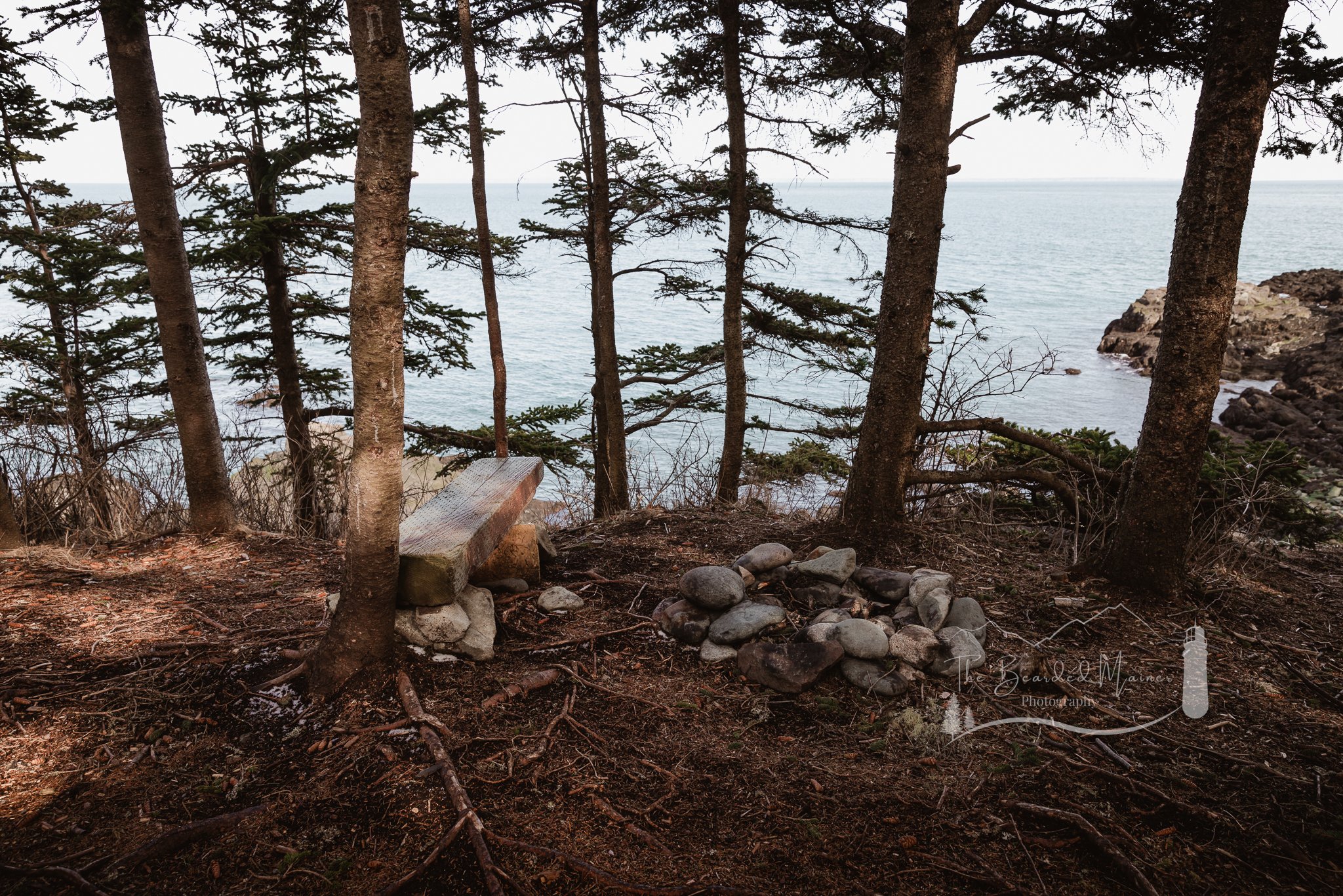
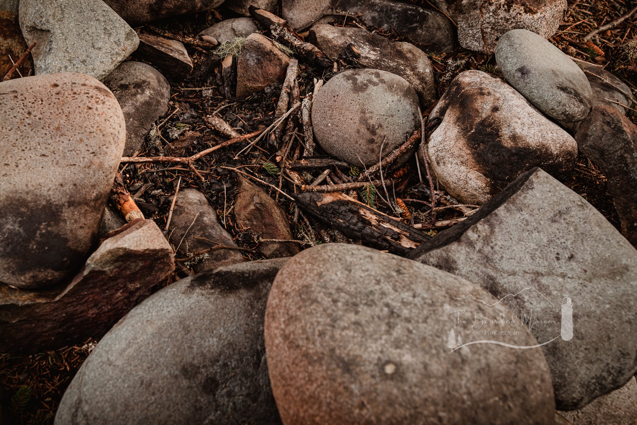
The campsite at Black Point Cove was well cleared, though there was little open space for setting up a tent. Multiple small fire rings have been assembled throughout the campsite area. This campsite also features a gorgeous rocky beach, though not as suitable for swimming as the next campsite.
I should note, that if waking up on a rocky Maine beach doesn’t do it for you, these sites may not be suitable for your type of experience. But if you want to sleep to the sounds of the ocean, bathe in the chilly waters of Grand Manan Channel, and frolic among the trees with no sign of modern life for miles around; then this is your place. We decided this was a good spot to take a rest, eat a snack, and get ready for the remainder of the trail.

Shaun reflecting on his images at Black Point Cove campsite. Photo Credit Whimsy and Wilderness Photography
Had we known at this time what we were in for on the Inland Trail, we would have turned around and taken the Black Point Brook Cutoff Trail that was just a short distance back from the Black Point Cove campsite. But we didn’t. So we stubbornly trekked on toward the campsite at Long Point. At this time it was just after 4pm, and we still had many miles ahead of us. We thought for sure we could finish quickly if we just put down our cameras and kept walking.
The campsite at Long Point was my favorite of the two we saw. It had nice open clearings, and plenty of space for friends or family to join you. The trail all around this site was exciting and full of great features to explore. I should also remark that these campsites were CLEAN and well cared for. Though, we did come across a few coves and points along the trail with washed up debris, trash, lobster traps, and buoys on a number of occasions. We even saw a buoy from a boat out of Stonington!
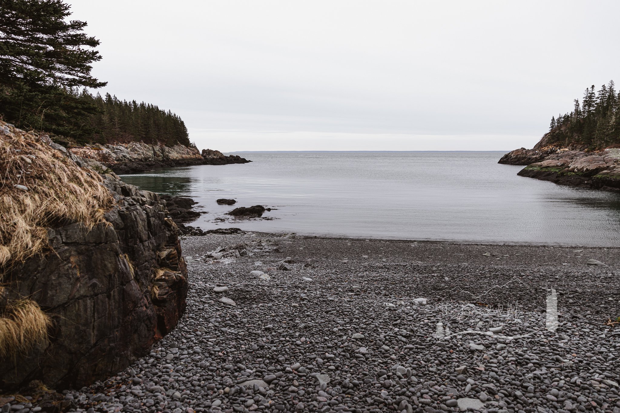
The view within the cove at Long Point campsite was STUNNING. I actually lost my breath when I stepped out of the tree line and saw the cove and beach. The beach felt full of peaceful energy. If it had not been the end of March and the water was warmer, I would have been forced to strip down and jump in for a refreshing swim! The water was so clear and clean, the rocks were smooth and polished, and there wasn’t a soul in site. It felt as though even our whispers echoed off this cove. After losing precious time admiring the views at this campsite, we continued along our journey. We had no idea, but the challenge of this hike was just beginning.
A Hard Decision
We arrived at Fairy Head at 6:30 pm. Sunset was nearly upon us. Our bodies were sore and worn. Dark clouds were rolling in over the horizon, blocking almost all remaining sunlight.

Old wooden bridge on the Coastal Trail in Cutler Coast Public Reserved land
Looking at our map, we reflected on our journey thus far. How had we already been on the trail for six hours? We still had over four miles ahead of us too if we continued along with the Inland Trail.
Our confusion came from our understanding on All Trails that this loop could be done in five to six hours. At this point we knew what happened. That five to six hours meant taking the Black Point Brook Cutoff Trail back by the Black Point Cove campsite. Further research before our hike would have informed us that this is an 8 hour hike, under good trail conditions. Something we didn’t have.
After a serious discussion we agreed and made the hard decision that continuing forward was our only option as the sunlight left the sky. We held hope that the Inland Trail would be an easier trek than doubling back the way we had came. We were deep in the Downeast woods… and the sun was no longer our ally.
Before carrying on, we packed up our cameras. We’d have no need for them along the remaining trail; there was no light.
Fortunate for us, Stephanie was the far better prepper on this journey, and packed her headlamp. Me on the other hand, I FAILED this assignment. I had banked on that five to six hour hike length All Trails reported, so I didn’t pack my headlamp. The last time I had to hike with one, I was climbing the Beehive in the dark to photograph a sunrise proposal overlooking Acadia. If only I had remembered that powerhouse of a headlamp for this trip!


Stephanie and I agreed we would preserve the battery power and walk with what little natural light remained. We did this until we could no longer see the stones and roots before us. By the time we decided to start using the headlamp, we realized the next mistake we had made.
We were seriously wrong about the conditions on the Inland Trail.
Inland Trail
Now this is where our journey on Fairy Head Loop got scary. We don’t have photos from this time since we both put away our cameras.
The blow downs were ferocious and seemingly endless. I have rarely seen such destruction on a trail. To make matters worse, I could only ‘see’ what was ahead of Stephanie, and the shadows of things behind her. I let her take the lead on this one with her headlamp. She has an eagle eye for those easy-to-miss blazes that were very few, and VERY far away from each other in spots. She also has a sharp sense of direction and a Mother Bear personality. If time has taught me anything, you let that Mama Bear of the group lead. If ever I end up lost in the woods (we kind of did), I want to do it with this rockstar (again). Want to see what this trail looks like from Stephanie’s perspective, and read her well thought out trail review? Visit the Whimsy and Wilderness Photography Blog about our trip to Fairy Head Loop Trail! She does a wonderful job expressing the desperation, disorientation, and exhaustion we experienced on our trip.

Now, I have read stories of folks who got lost in the woods due to fatigue and disorientation. Then I thought, how would I handle that situation? Surely I’d keep my cool and find my way out. We learned on this particular night just how easy it is for the wilderness to win.
We walked along, joints beginning to ache from fatigue, we kept positive conversation as we ascended up what felt like small mountains, and back down again into valleys. In one particular dip, we began noticing significant piles of Moose droppings. As I lifted my gaze from the shadowy ground at my feet, I saw what appeared to be a pond to our right. The amount of Moose droppings had me concerned we were in their territory, and a Moose was the last thing I wanted to deal with this particular evening. We picked up the pace at this point to get away from the waters edge. Looking back on the map now, I believe what I was looking at was a marshy portion of Black Point Brook.
Shortly after this point, my phone died as we approached the intersection of the Inland Trail and the Black Point Brooke Cutoff Trail, and my trail tracking on All Trails was paused. From here, we still had nearly two miles to go before the Trail Head would be in sight. The time was 9:50 pm.
Fatigue and Disorientation
Absolute exhaustion was overtaking our fatigue. Pain was settling into our bodies. Due to this our pace was slowed. This is when the serious discussion whether we should camp out for the night occurred. Neither of us had the physical or mental energy to climb many more blow downs or scale any more elevation points. We had already been taking off our packs and tossing them across the blow downs so we could crawl under, as our legs would no longer allow us to go OVER. We couldn’t go around, for fear that the detours would take us too far from the trail to find it again in the dark. At the same time, my stomach filled with rocks when I thought about being stuck in these woods for the night, unaware of what surrounded us.
The last recording my phone took before the battery died.
Stephanie had everything we needed to weather a night, and I had brought plenty of food and layers to keep us fed and warm, but something about sleeping in the woods was not about to settle with me. So we agreed to keep going, on the basis that if we got off trail at all again, we would stop where we stood and stay the night. That I could agree with.
It felt as though the trees were playing childish games on us with every flicker of a shadow or creek of a limb. The silence left me feeling deaf, questioning whether the world around us was truly that quiet, or that our ears had left us with the sunlight hours ago.
We saw on the map that there was a detour coming up that had been closed. We identified the detour and continued on the open portion of trail. Soon we reached the swampy watery edge of what looked like a bog, with the trail disappearing into the water. After looking around carefully we determined the bridge that once stood here had been washed away or otherwise destroyed. We couldn’t see an easy way around. At this stage my give a damn was completely busted, as we trudged out ankle deep into this mushy, sloshy mess and made our way across; hoping our ankles would be as deep as it got. Only once did I sink above the top of my boot. My foot was now wet, but that was the least of my concerns. We kept pushing. Days later we learned this was a location washed out by a beaver dam that had not yet been repaired. We did notice near the end of the trail where work on clearing trees and rebuilding boardwalks had begun.
After this point, a lot of the journey becomes blurry for me. I was really distraught over my decision to wade through that water without knowing what I was getting into. My strength to fight my anxiety of what lie in the dark was growing weak. Add to that I could only see the ‘shadows’ of things along the path as I followed Stephanie with her headlamp but even those began to dance and play theatrics before my eyes. The narrowing, overgrown trail and rotted, collapsing, and loose boardwalks were exhausting to follow with blurry eyes, and my own breathing or the brush of my bag against a tree limb was enough to spook me in the silence.
Stephanie was ahead of me still, fighting back dry heaves from dehydration. Though she had extra water in her pack, she lacked even the energy to take her backpack off to grab it. We began sharing my water bottle that I already had out so we could keep moving toward the end of this unforgiving, and taxing trail.
Hitting our limit…

Shaun scrambling over a blow down on the Inland Trail after dark.
and we had no choice but to crash through it. With our spirits on the verge of breaking, Stephanie asked if she could play some music. I’m not one to normally support playing music on the trail, but at this time, some good ol’ musical theatre tunes was EXACTLY what we needed if we were going to make it out of there. It was a good choice too. The energy of the music was felt through my body and helped keep one sore, soggy, and blistered foot in front of the other.
Climbing the final blow down— the first one we scaled at the beginning of the day, we were in sight of the parking lot. If we could have run, we would have. When we reached the truck at a little past 11 pm, we both let every emotion we had been feeling release from our bodies. We cried, cheered, dry heaved, and took a moment to breathe.
Ten minutes into our ride home snow began falling. Had that happened while we were on the trail, I’m not sure how I’d have coped with that.
Our long ride home was full of leg cramps, and heavy sighs, but far less eventful than our journey along Fairy Head Loop.
I’ve never felt more thankful for a middle of the night Circle K coffee. Thanks Circle K Machias!
Tips For Hiking Fairy Head Loop Trail
This trail is not for the beginner or intermediate hiker. To complete the entire loop you will be putting your body to the test out there.
You will want to have experience navigating without digital assistance too. Cell service is spotty, and again, it is very easy to get off-trail. If relying on a virtual map, make sure you have downloaded it for offline use, and brought along a backup battery back incase your phone battery dies. I’d also recommend bringing a printed map and a compass, just in case.
Bring extra food and water. It is always better to have extra, than not enough. Stephanie did find a running stream to take a sip early on in our trip just for fun, but there is no guarantee there will be a fresh water supply available out there.
Head lamp and extra batteries. Just as we had not expected to be out after dark, anything can happen that could cause you to fall behind your planned arrival time. It is very important to have a light source with you just incase you find yourself in the woods after dark.
Survival gear. You should have a few basics with you so you can weather a night if you get injured or lost. This is a long trail and help is even further away. You will need to be resourceful out here if tragedy strikes.
Don’t go alone. This one should speak for itself.
Check more than one trail info source. I think All Trails is a great place to find and wishlist trails, but before your hike you should always check a second reliable source. Here in Maine you can utilize www.mainetrailfinder.com. Had we done this we would have known that the Inland Trail was washed out, the loop actually takes 8-9 hours, and the trail is not well marked and has misleading trails. Let our experience be an example to you. ALWAYS know before you go. Also, don’t go alone, yes I’m a broken record on this one.
Hiking One of Maine’s Most Challenging Coastal Trails
Hiking Fairy Head Loop in Cutler Coast Public Reserved Land was one of the most humbling, challenging, and rewarding outdoor experiences I have ever had. Everything about my person was challenged— my perseverance, my physical strength, my ability to set aside my fear, my hiking etiquette, my survivalist skills. Everything was laid on the table to get through this hike, and I’d do it all over again! Next time however, I’ll make sure to start on time, leave plenty of time, pack more chewing gum (two sticks of Orbit was NOT enough), bring my headlamp and extra batteries, better research the current trail conditions, and bring along my favorite hiking buddy. I’d recommend this trail to anyone who has experience with challenging trails, but I’d say keep the kiddos away, unless you plan to just do an out and back on the Coastal Trail. Even then, be over prepared for the elements you will face out there, especially if bringing kiddo’s along.
This trail is great, if you’re ready for it.
See you on the trails!
Shaun Crockett - The Bearded Mainer Photography
Please note: Your safety, planning, ability level, and preparedness when hiking any trail is your own responsibility. Any recommendations or tips provided here may not work for everyone; and that’s ok! Please use your own judgement when setting out on any wilderness adventure!
Check out more from my blog!


Fairy Head Loop Trail is part of the Cutler Coast Public Reserved Land in Cutler, Maine. It is an ambitious and challenging 10.4 mile loop trail situated along the dramatic coastline of Downeast Maine. It has an overall elevation gain of 1,076 feet, and features rock and ledge scrambling, forested trails, boardwalks, stepping stones, and a climbing rope for accessing the trail at the top of a steep banking. Multiple campsites can be found along the trail and feature stunning views of Grand Manan Channel.